

Choose the hike by terrain and current access, not by fame
Hawaiʻi hiking is unusually varied: a paved crater climb on Oʻahu, wet rainforest on Maui, exposed coastal trail on Kauaʻi and live volcanic terrain on Hawaiʻi Island can all sit under the same word “hike”. I would pick the route by surface, elevation, weather and current park status before looking at the photo payoff. Storm damage, volcanic activity and reservation rules can change a perfectly sensible plan into a closed or poor choice overnight.
Easy-to-moderate choices when you want a defined route
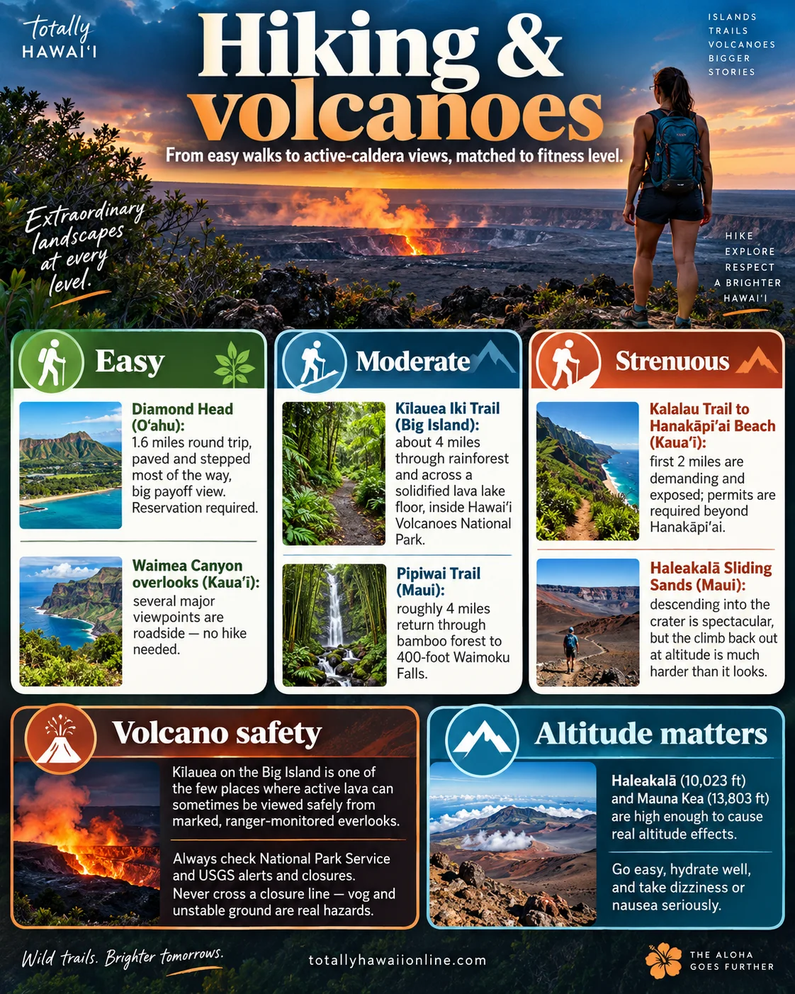
Diamond Head State Monument (Oʻahu) is the straightforward urban option: a short crater hike with paved and stepped sections rather than a wilderness trail. Non-Hawaiʻi residents need an advance reservation, so I would book the slot before building the rest of a Honolulu day around it. Heat and stairs matter more than the mileage.
Kīlauea Iki (Hawaiʻi Island) is a much more natural outing through rainforest and volcanic landscape inside Hawaiʻi Volcanoes National Park. The useful habit is to check the park conditions page first. Kīlauea has been erupting intermittently in 2026, and the eruption area itself is closed even when marked caldera-rim viewpoints and other trails are open.
Haleakalā: descending is the easy-looking half
At Haleakalā, the Keoneheʻeheʻe (Sliding Sands) trail can be sampled at a short overlook or turned into a serious wilderness day. The National Park Service currently lists the trail open, but the crater floor is roughly 3.9 miles downhill one way with about 2,500 feet of elevation loss. I would decide the turnaround point before descending. At nearly 10,000 feet, cool wind, sun exposure and altitude can make the climb out far harder than the first hour suggests.
The sunrise reservation system is a vehicle-entry rule for 3:00–7:00 a.m., not a general hiking permit. Do not confuse it with permission to hike or bike elsewhere in the park.
Kauaʻi: Hanakāpīʻai day use and Kalalau camping are different permissions
This is where old guides regularly muddy the rules. For non-residents, hiking from Hāʻena State Park to Hanakāpīʻai Beach or Hanakāpīʻai Falls requires a current Hāʻena park entry, parking or shuttle reservation. You do not need a Kalalau camping permit merely to day-hike to Hanakāpīʻai. A camping permit is required if you continue beyond Hanakāpīʻai Valley into the Nāpali Coast State Wilderness Park.
The coast is also weather-sensitive. I would treat a reservation as permission to enter, not proof the route is safe or open; read same-day DLNR park notices and turn around if stream, surf or trail conditions are deteriorating.
Volcano viewing: the closure line is part of the experience
Kīlauea is active, but “active volcano” does not mean you can walk to the lava. Current National Park Service guidance keeps eruptive areas closed because hazards include volcanic gas, unstable cliff edges, cracks and falling tephra. When activity is visible, use the open, marked viewpoints the park identifies and expect parking and traffic pressure during eruptive episodes.
I would check both the Hawaiʻi Volcanoes National Park conditions page and the USGS Hawaiian Volcano Observatory before leaving accommodation. Never cross a barrier to improve a photograph.
Altitude: do not combine every summit idea into one day
Haleakalā’s summit district and Maunakea’s upper elevations can produce headache, breathlessness and nausea in people who felt fine at sea level. Hydration helps, but it does not cancel altitude. I would keep the first hour conservative, avoid hard exertion immediately after a rapid ascent and descend if symptoms are worsening.
For Maunakea specifically, check the current Visitor Information Station and summit-access guidance rather than assuming a rental car, weather forecast or personal fitness automatically makes the upper road appropriate.
My pre-hike checklist
- Managing agency: NPS, Hawaiʻi State Parks or Nā Ala Hele — know who actually controls the route.
- Current status: closure, storm damage, volcanic activity and road access checked the same day.
- Reservation: confirm whether entry, parking, shuttle or overnight permission is required.
- Surface: stairs, mud, lava rock, stream crossings and exposed coastline are different problems.
- Turnaround: set it before fatigue or weather makes the decision for you.
- Offline plan: save the map and tell someone where you are going when the route is remote.
Sources checked 6 September 2026: Hawaiʻi DLNR State Parks current Hāʻena/Kalalau and Diamond Head access notices; Haleakalā National Park hiking guidance; Hawaiʻi Volcanoes National Park current eruption/closure updates; USGS Hawaiian Volcano Observatory.
Cheers, Carpe Diem & let the trail status choose the adventure, not the old screenshot! 🍻⏳🥾
TATS Man
Your crater-rim and turnaround-point planner